| The Glyndwr Fishery is situated on the River Vyrnwy in Mid Wales, approximately 12 miles north-west of Welshpool. It is approximately 30miles from Shrewsbury and 30 miles from Dolgellau. |  |
Wild brown trout and Grayling fishing on the River Vyrnwy
| The Glyndwr Fishery is situated on the River Vyrnwy in Mid Wales, approximately 12 miles north-west of Welshpool. It is approximately 30miles from Shrewsbury and 30 miles from Dolgellau. | |
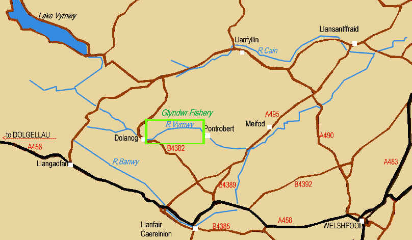
To reach the fishery, take the A458 from Welshpool, and travel west as far as Heniarth. Turn off right, and near the top of the hill, turn left onto the B4382 for Dolanog which is approximately a further 4 miles. (You will cross the A495 after approximately 1 mile). The road crosses the river and you pass the church. On the bend, turn off right, go up a short hill and then take the next right (marked no through road) and you will drop down to Mill Farm and the river. This marks the upstream boundary of the fishery on the left bank.
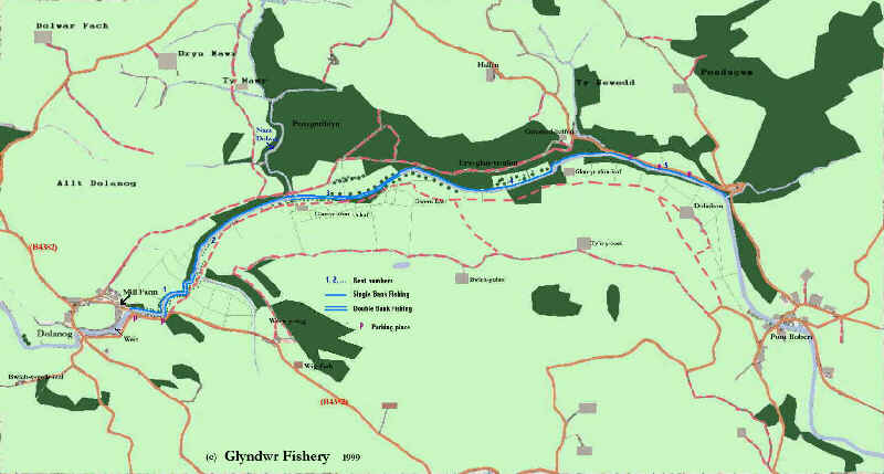
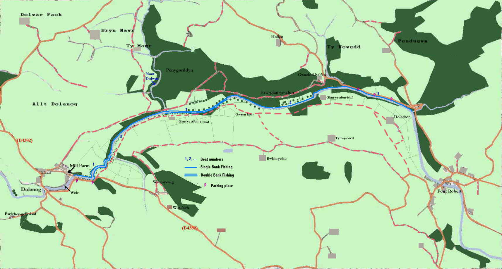
The upstream limit of the fishery is Mill farm Dolanog where there is still evidence of a road which crossed the river before the girder bridge was washed away. From here it runs continuously for approximately 2.5miles downstreeam to just above Pontrobert on the left bank. Two of the five beats are both right and left bank fishing.
![]()